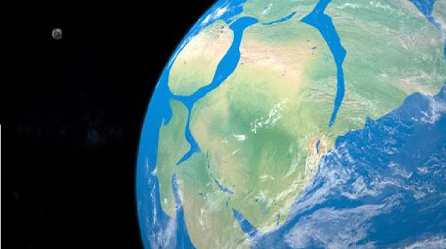
Earth is not a static, unchanging ball of rock. Your day-to-day perception of the ground you stand on might suggest otherwise, but our planet is an ever-changing, shape-shifting globule of crust floating around a molten sphere of mantle and metals.
In a beautiful illustration of this, scientists have put together a 1-minute video showing the movement of Earth’s tectonic and plate boundaries over the past 1.8 billion years (a mere 40 percent of its history).
It comes from a new study by geologists from Australia and China that refined some of the pre-existing models of Earth’s tectonic and plate boundary evolution using new geophysical data and improved simulation software.
The video starts in the 21st century with all the continents we know today – North America, South America, Europe, Asia, Africa, Australia, and Antarctica – and works backward in time.
Within just a few million years, the continental plates begin to bend and squish toward each other. Around 200 million years ago, we see the emergence of Pangaea, the supercontinent associated with the age of dinosaurs that was created approximately 335 million years ago.
As millions of years fly by, we then witness the creation of other supercontinents and tectonic break-ups. For instance, there’s the supercontinent Rodinia, which was created by the split of an older supercontinent called Nuna about 1.35 billion years ago.
The geological period between 1.8 billion and 0.8 billion years ago is sometimes called the “boring billion” because some models suggest it is a period of relative tectonic stability with little movement. However, this latest model suggests this is an unreasonably harsh assessment. The “boring billion” was, in fact, a lengthy time of dynamic geological activity.
This is not the end of the story for Earth’s tectonic plates. Our planet’s surface is still undergoing radical changes, albeit very slowly.
A vivid illustration of this can be seen in Africa, which features a colossal rift that stretches downward for thousands of kilometers through Ethiopia, Kenya, the Democratic Republic of the Congo, Uganda, Rwanda, Burundi, Zambia, Tanzania, Malawi, and Mozambique. In 5 to 10 million years, this growing rift could see part of East Africa chip off from the rest of the continent, likely resulting in a new ocean arising between the two land masses. Africa, as we know it, will effectively be split in two.
Even more extreme changes will be seen even further ahead in the future. Modeling of tectonic movement suggests that our planet will bear a new supercontinent around 200 million years from now. However, it could pan out in several different ways.
One idea involves the formation of a supercontinent called "Amasia,” in which all the continents except Antarctica could huddle together around the North Pole. Another possible scenario is “Aurica,” in which the land is gathered on the equator. A vastly different world is ahead of us, but it’s not certain how it might take shape.
The study is published in the journal Geoscience Frontiers.


No comments